Lost Soul in Prairie Purgatory
The Lost Soul: Lethbridge Alberta Canada. Fifty K, Hundred K, Hundred Miler. Sept 14th and 15th (Friday and Saturday) Billed as the Toughest Race on the Prairie.
Never let it be said that the ultra runners of Alberta Canada do not give themselves a challenge of the highest degree. They call the Lost Soul 100 Miler the toughest race on the Prairie, and there is not doubt of that– I can testify to the truth of this claim, and after enduring the course for over 33 hours feel confident that it that it will ultimately be ranked among the toughest 100 milers of North America.
On paper this race is not impressive. First of all the measurements are given in meters, and they just don’t relay height to a denizen of the south like feet. I looked at the total elevation gain and loss and the 3950 number didn’t seem that bad. Anyway how hard could climbing up and down rolling prairie be I reasoned? I had just completed the Teton 100 and that had some real mountains to climb. A prairie run? I arrived regarding it as a tuner for my next 100 miler.
The morning after my arrival I wandered over to the Lethbridge Lodge to check out some of the course as the race’s main aid station is in the Lodge’s parking lot. Well I have to admit it was a bit of a shock when I came out the rear door of the Lodge and wandered toward the river valley that sits at the back of the lot. The first thing that struck me was the incredibly high rail road trestle that spans the valley—a long thin black ribbon of rail supported by a black web of steel girders; a truly amazing and surprisingly beautiful structure. But what had me gulping was its height above the Old Man River that flowed under it deep down in the valley. Looking over the narrow valley I felt a sudden chill and a bit of panic when I realized the length of the valley was not lined with rolling prairie hills but Coulee’s, or as the Spanish would call them Arroyo’s, with deeply weathered sides, up and down which ran some of the steepest looking trails I ever imagined could run through prairie grasses. I stood there suddenly feeling that I had once again been a bit over confident, and had let a slight HURT arrogance get me into a very difficult venture.
If you have ever run the coastal hills of California that stretch from San Diego north to beyond Big Sur which are filled with dry steep Arroyo’s that work themselves jaggedly inland then you have some idea of what the Coulee’s look like that the Old Man River has carved out of the Alberta Prairie. My favorites would be the hills near San Louis Obispo, or Los Osos, in the Montana de Oro state park where they run a 50 miler. In Hawaii, if you cover the canyons of Kauai’s Waimea with the grasses of Kona you can come close. Or look at the rugged hills of far Ewa, or, better yet, the far eastern Ko’olau that break apart at Makapu’u. Take the trails that lead from the upper road down to Makapu’u Beach and mentally extend them up the beyond the road to the heights where the hang gliders used to launch. Steep gritty trails littered with rocks and hardship climbing up high hills where the crest can be gained in a maximum of fifteen or twenty minutes of intense effort. Not like a Manoa, or a Nu’uanu where times are over 30 minutes and often can seem forever, but kind of a denuded Hog Back made of eons of mud mixed with just as much river rock. And for fun instead of just climbing the spine of the ridge, we occasionally go up and down the steep sides of the Hog Back down to the Moleka stream, along the rugged bottom land, and then, sadistically, back up and out, and over and down the other side. Think about doing some mad man’s endless run up and down all the possible ascents and descents of the Hog Back, think about what that would do to you mentally and physically as the hours ticked by, think what your knees and joints would be saying to you far into the night. That’s right!—It’s a thirty plus hour ‘Twelve Hour’ endurance run—only Big John has decided we do washing machine loops to keep it interesting.
If you look at the layout of the race it really does not appear that difficult. Much of the race is run on the flats of the high open plains or on the low bottom lands along the river. But even on these long relatively level stretches there are a lot of technical issues that often make it difficult. One’s eyes are irresistibly drawn to the long vast horizon, but the rocks and holes never stop littering the path as one gazes out. It was not until fatigue began to overtake me that the awe of the prairies subsided and I stopped stumbling over rocks and into holes. Sounds stupid, but I passed one local runner who had turned his ankle, and a few others who were gimping along –seems to be one of those common problems of this vast land. Down in the bottoms, the river land was largely twisty turny land through rough pasture, and torn-up gravel mines. There was, however a lot of time to appreciate the Cottonwood groves along the Old Man River and the plentiful migrating bird life.
The course is basically six sections. There is the southern loop, the half loops between the three aid stations, the full loop at the north, and the half loops back between aid stations and toward the Lodge. The first section runs south of the Lodge through the high coulees of Lethbridge City Park land. It winds up and down single track trail and some public paved or gravel path and around a police training gun range that gives the loop its name. The loop ends with a final steep climb out of the bottom land and back to the Lodge. We ran this in the cool of the morning and I was immediately last. I could not believe the pace, and I fell farther and farther behind the main group, passing only a couple of elderly women who seemed entirely out of place in a race like this, but who managed to kick my ass for a few miles none the less, and it was not until the final upward hill that I managed to move ahead of them.
The second section goes north to the Penman aid station, and then, on the return, back along the river bottom land. This section can be viewed as part of the middle of the course, but part of it is run out and the other part on the return, each time you stop at the aid station before continuing on. Its outward or northern portion is primarily a section of difficult coulee traverses with a few moderate upland passages. These are not the worst of the hills on the course, but they are taxing, and it is here that one becomes aware of difficult nature of even the most benign looking coulee tracks—almost everything slopes right to left—the high prairie land on the east, and the river bottom to the west, and the runner almost always headed north on the way out. Four hours into the race and my right ankle was giving me a real problem from being constantly cantered out (suponated?), and I had to stop and stretch it repeatedly. Many of the runners of Alberta use walking poles, and after a few miles of these coulee tracks it is easy to understand why. Poles in this kind of ground can be used quite effectively and can help a runner increase pace and reduce body wear.
Perhaps the most interesting aspects of these coulee tracks are the very steep cliffs that seem to appear abruptly on knife edge ridges or at the summits. Many of these are just disturbing views down into deep gullied forsaken ravines; others offer the unsettling vista of a trail that seems to lead down and out into nowhere. You quickly learn that the only way down is to keep moving as to stop simply means you start to slide uncontrolled toward the edge at some kink in the trail—again hiking poles can be of great assistance in these treacherous situations. When you get down to the bottom, well… the trail picks another ridge and winds its way up toward the top, first indirectly through minor canyons and rills, and then abruptly—straight up the steep hillside for a ten to fifteen minute hard climb—as if the race directors grew impatient and suddenly decided to move on to the next set of torments. Then there are the long upland winding trails through undulating prairie land, which inevitably wander toward some heavily marked ribboned area that leads the runner off a cliff and back down into the purgatory of the ravines.
On my first trip out I became convinced that the Canadians had simply changed the name of their measurement, that what they called kilometers were just renamed miles—again, needing someone to focus my scorn on I blamed the race directors’ sadistic nature. The word was that this was a two bottle course, and there are water refueling drops between aid stations. I used a camel pack and in the heat of the day, which was significant, was often sucking up sixty ounces of water between stations. There are three well run aid stations, and a forth one stocked by a private individual whose land the course passes through. I learned early that it is important to take advantage of these stations as they are not that close together, and in the day’s heat or the cool night the distances seem to lengthen.
Into the middle station at Peenaquim and out again on another long series of coulee ascents and descents. A long upland section is runable if you have the energy, and then again it is back into the gulches and bottom land before you make your way to the Pavan aid station. From Pavan it is one long loop of Coolies out and then bottom land back. I heard grumbling from some who had done the race before that there were more hills on the course this year and the farthest ones were singled out as new. Again the idea that the bottom land is easier is a fallacy. The trail often passed along rocky and heavily cattle trodden land along rivers and ponds. If it wasn’t the cattle tracks, it was the rocks that made footing hard. Then there are the rocks of the gravel quarry lands, and the rocks of the river shore, and the rocks that just work themselves out of the ground and lay anywhere they decide to surface. To be sure there will be one where you least expect it to be.
But the bottom lands offer a change, and for much of their winding passage threaten no hard climbs or descents. It was just on the edge of Fall and the cottonwoods were beginning to turn and the yellows of the leaves were fresh and beautiful against the dark greens of the heavily wooded areas. One often sees vista’s that seem to reflect how things were before, when the seasons came and went and there were no gravel quarries, mines, or other scares on the land. You can stand up on a hillside, look down at the deep winding valley of the Old Man River, and hear the call of migrating geese or ducks before you catch sight of a large flock circling in V formation just before coming to rest on a river backwater. And if you don’t fall down and break your leg as you do this, the vision will be well worth the trip up to Lethbridge to make the run.
Once again the RD’s lied about the distances and it is a lot longer between the aid stations. It doesn’t matter that you are not going up and down, the trip back seemed to take me longer than it should have—anyway I have gained new respect for the kilometer. Leaving the Pavan aid station the path looks clear to the south, but suddenly the hills collide with the river and force themselves into the path of the river. These are not happy hills and they seem to have scrunched themselves up a bit, trying to resist the endless wear of the Old Man as it rushes by. The trial winds around the bottom of the first hill, giving a false sense of hope, and then there is sharp cut ravine that leads to one of the steepest climbs of the course. There are foot marks and holes in the hillside, and one can rest a hand on the vegetation to the side if need be. But don’t look down or slip. I can not tell you what would happen, I just kept climbing, and doing that ‘huff and puff ‘ I learned up on Mauna Kea. And then I was up, and looking down a very long steep trail. Not the longest or steepest on the course but ranking high in all categories. Down that, praying my knees would still be talking to me, around another small hill—the trail high over the river just below—well, not just below, but no more than a hundred foot fall off a very narrow trail. Down another set of sharp switchbacks and there you are, looking at a Three hundred foot climb that has to approach seventy percent grade over much of its rise. And then, you make that wondering if the heart is not going to finally pop and its down again, ehh. Steep one too. And you understand why the majority of runners were using those hiking poles. Jam one in and slide down it. Jam the next one in and slide down that, eh—only way to go down it without blowing out your joints, eh.
The rest of the way back is more rough bottom land trail. Pretty except for the part along the waste treatment areas. Under the high rail bridge and you have ten minutes to the final climb out of the bottom land. Its right past a replica of old Fort Whoop-up, the first of Lethbridge’s population centers.
So…I believe there were over fifty starters for the hundred miler. There were about twenty plus DNF’s. Some of that I attribute to over exuberance and a willingness of our Canadian brothers and sisters to beat themselves up really bad, eh. I felt there was some failure to properly carbo load and watch electrolytes. There were a lot of people I passed in the aid stations who were just done in. I found another lady wandering the trail in the wrong direction. She was a bit dazed and seemed to have problems just following me, even though I slowed to keep her with me. At the Pevan aid station I told her to give continuing long hard thought. There were just too many cliffs and isolated ravines to fall into, and disorientation was upping the odds to a dangerous level. The trails did substantial damage to bodies and minds of their own accord. It’s very hard to keep going up and down those coulees. Once again, if a hundred miler becomes something that has a good chance of killing you, then its time to stop.
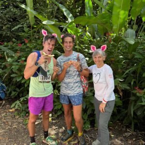
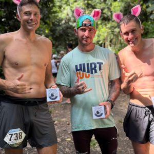
The winning time was 23 hours and something. The two lead runners passed me as I neared the end of my second lap. Both were using hiking poles. My splits were 10:45, 12:15 for the night loop, 10:11 for the final loop—and I am happy and proud of the 33:11 I earned. Instead of belt buckle the race prize is an engraved rock. That’s right, I have a 50 pound rock with the Lost Soul logo on it and my name and time chiseled into it. If the race had been just a little tougher it could have served as a headstone. This race is the final in the Alberta Ultra Series and there were a lot of very good runners in the event. The race event included a breakfast on Sunday where all the fifty K, hundred K and Hundred milers packed into a very large ball room. There was a lot of enthusiasm and spirit. One striking thing was a lot more females than I have seen at other runs. I have to say that Alberta has more than its fair share of very good looking Ultra running women—and not just the under fifty age group as there were plenty of very fit ladies who claimed their age group prizes.
The Alberta runners, the volunteers of Lethbridge, and the race directors and staff were all very welcoming. It was a very nice experience. The town is a charming community and the prairie unsettlingly beautiful. In many ways the story of Lethbridge is the tale of how the Canadians handled the settlement of the West. And it is a story of a much kinder side of the human condition than was exhibited just to the south. Here there are no Custers or Wounded Knee’s. The Mounties made peace with the indigenous peoples, restricted the use of alcohol as best they could and tried to leave a desperate people with some honor. That sense of humanity still shines through.
I almost did not finish. Somewhere out there on the gun range, first section of the third loop, I became convinced that I had to do an extra 10 miles after I finished the third loop. Time wise it just seemed impossible. I was quite depressed by this and when I got back to the Lodge aid station I asked about this. Turns out I had been running fifty-five or so Kilometer loops and not 50 k as I had thought. Jokingly the staff at the station told me I could run the extra distance if I was really uncertain of the kilo to mile conversions they used. It explained why my times were so slow, and instantly turned a dark morning into a very cheerful and sunny day. I went out on the first two sections of my last loop, and though working hard at it, evidently was not concentrating on the pace as much as I should have. Times were slow when I got to the far station and there looked to be a good chance that I would be pulled at thirty-two hours if I failed to get out of that station on the return by the thrity-two hour limit. It was at that point that I finally decided to run. I turned my second loop four hour plus for the section into a two hour plus on the third. I caught up with the trailing pack and passed people all the way to the final few hundred yards. It was just about as much running as I could handle.
The lay-out of this race means that you almost never pass a returning runner. Once the race started I found myself alone; and I mean very alone and almost isolated. With the exception of the people in the aid station I ran the first 23 hours almost entirely by myself and out of sight of almost all other runners. Often at night I could not even see the lights of other runners—just the dark outline of the prairie highlighted against the brightness of a sky filled with starlight—at those particular moments, in the deep darkness of the moonless night, the coyotes howling on the next ridge, there seemed no more appropriate name for this beautiful and at times desperate run than the Lost Soul.